Holy smokes! So many people are into maps. It's great!
Daydream sent me this link from boingboing.
This Karen O'Leary lady has done so many of these things I don't know where to begin.
Here's a Vancouver piece from her Etsy page (Etsy of course being an online fashion/art/handmade stuff marketplace that comes highly recommended by Ms Fascinator, amongst others).
 On this one it looks like she has used an actual map and simply cut out all the bits that aren't roads, really showing how it's the roads that tie the city together. Cut the other way and remove the roads and all you have is a bunch of squares floating to the ground.
But if it's the roads that are holding the city together shouldn't we be making more efforts to ensure roads are given over to people, not cars? Of course we should. It seems dumb to exclude the actors that bring life to the city from the physical space wherein the city's component parts are secured to one another. I'm not saying ban cars, just think about it for a moment and you'll catch my drift.

According to her description this map of Paris is made with heavier stock, watercolour paper. I assume she traced everything on then went about cutting it in the same way.
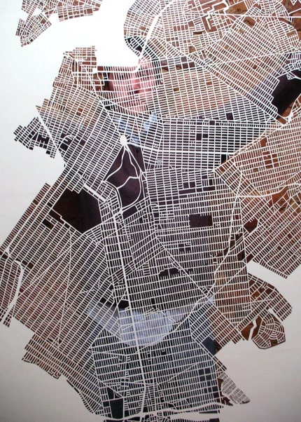
And again, something similar with New York. This is one from a set covering the whole city and is apparently done on lighter paper.
There are a whole whack more of these on her Flickr.
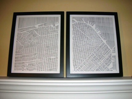
 NYC again.
Keen, really just keen.
She also does some in pen and paper.
 Great. And then she can put them onto cards, magnets, etc.
I'm super glad this was sent to me. These pieces are great and show me some possibilities. I've been chopping up a few things lately (I need a better knife and chopping surface) but the idea to remove most things and leave only roads in situ never crossed my mind.
I skipped right past that step and have been thinking about manipulating roads. Cutting them from their surrounds but instead of leaving them, changing their configuration, hopefully so that the roads themselves are still recognizable while their form has gone haywire. I suppose that might mean they will become unrecognizable, but I guess that can be part of the fun too. Make an interesting and aesthetically pleasing image, using a map as material, and only later upon closer inspection will people realize that they're looking at something familiar.
Heh. I should DO that, then I won't need to wonder such things. I wonder if that idea would work better with a a provincial road map or a city street? Oh! Or if I used one of those map books for a city that are done with a large scale. Go from page to page, following a road, then mounting it somehow. Anyway...thoughts from my brain.
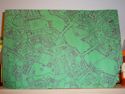
I'm reading a few of the comments people are posting below the boingboing article, asking whether the pieces are diminished if they were laser instead of hand cut. I don't have an answer to that, but I'll admit there were moments when I was drawing this map

that I was wondering if it wouldn't be better to just learn AutoCAD instead. Probably not. It's about the process after all and it's not like I'm interested in efficiency! Although now that I have my map in digital form I'll likely manipulate it eventually.
I suppose if I keep going with evenly measured maps then a computer construction might make more sense, but it's not like I could make this with a computer.
Why would I want to? As this marker on construction paper monstrosity and Ms O'Leary's efforts at hatching a city show, there is so much fun to be had with variety in making and manipulating maps. So, computers? Whatever!
That's enough from me, but in closing I'll mention that I recently made a connection between why I like maps and how I interact with the world more generally, but I'm not telling you yet. Hint: it's about the big picture!


No comments:
Post a Comment